-
Overview
Conference Week - August 2016
Sunday 21. Monday 22. Tuesday 23. Wednesday 24. Thursday 25. Friday 26. Saturday 27. Sunday 28. Code Sprint I Conference (including Talks, Keynote Speeches, Topic Talks, Scientific Track, Poster Session and Map Gallery)
Code Sprint II Workshops B2B Meeting Icebreaker Gala Event Pub Race Overview
Conference Week - August 2016
Sun 21. Code Sprint I Mon 22. Tue 23. B2B Meeting Wed 24. Thu 25. Gala Event Fri 26. Sat 27. Code Sprint II Sun 28. -
CRTL-F Version here (last updated 20th)
Conference Programme
24th - 26th August
- Wednesday, 24th
- Thursday, 25th
- Friday, 26th
-
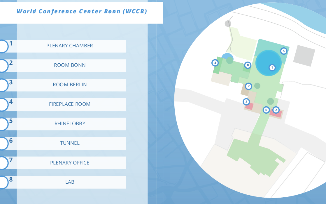
Conference Rooms
-
Keynoters
Our carefully selected keynoters will build bridges to the diversity of topics which they are specialised in. Look forward to our keynotes which will inspire you to build your own bridges to topics that might not have occurred to you before.
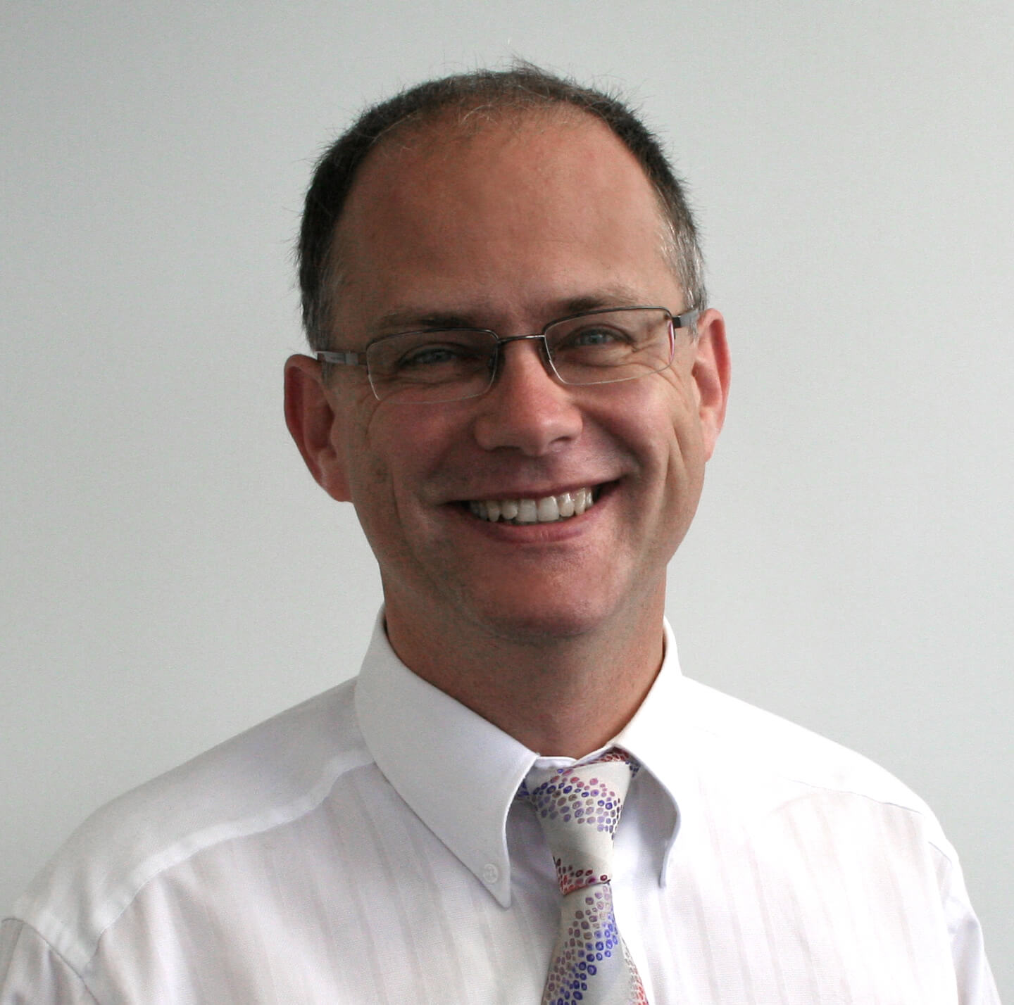
Andreas Veispak
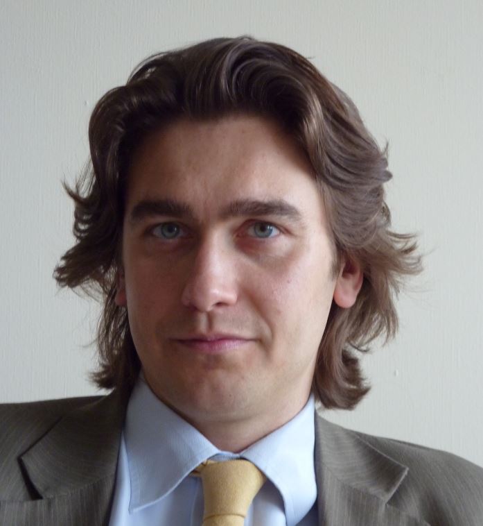
Andreas Veispak, an Estonian, started his professional career at PricewaterhouseCoopers, working on and leading numerous projects across different sectors of the economy (industry, financial and insurance, telecommunications, transport, energy, the public sector) in fields related to economic development, strategic advisory, mergers & acquisitions, project finance, public-private-partnerships, due diligence and corporate recovery. He joined the European Commission in 2005 where he dealt with the automotive industry and was responsible for questions related to industrial competitiveness, energy and the environment. Between 2010 and 2015 he joined the team of the Director General of DG GROW at the European Commission (internal market, industrial competitiveness, space – Copernicus and Galileo – entrepreneurship and SMEs). He is currently the Head of Unit for Space Data for Societal Challenges and Growth at the European Commission. Andreas was educated at the University of Oxford where he studied Modern History.
The Space Data unit has been set up recently to reflect the fact that the Copernicus programme has become operational and that the European Commission increasingly needs to focus on extracting as much value as possible from the data and information it delivers. The mission of the unit is to maximise the uptake and use of Copernicus (and space data more generally) among different user groups so as to fully exploit the societal and economic potential it offers.
More specifically, the unit is responsible for data policy, management, dissemination and access (essentially everything data related), for determining current and future user needs and promoting user uptake across different communities, for facilitating the development of new business models and stimulating innovation and new product/ service development in the downstream sector, for international relations of Copernicus as well as for communication and outreach activities.
Bianca Hoersch
Bianca, a German national, has been working at ESA’s Earth Observation Centre in Frascati, Italy, since 2004. As Third Party Mission Manager, Bianca has been responsible for ensuring access to Earth observation data from a wide range of partners around the globe, among them NASA, JAXA, ISRO, and KARI, interacting also with commercial data providers, European governments and user organisations.
In 2015, as Mission Manager of the Sentinel-2 Copernicus Mission, Bianca took over the end-to-end project responsibility for the satellites' exploitation phase.Bianca received a PhD in natural sciences from the University of Bonn, Germany, in a thesis with specialisation on high mountain remote sensing, geo-informatics and digital-elevation-models, supported by DLR and a scholarship of the German Research Council/DfG.
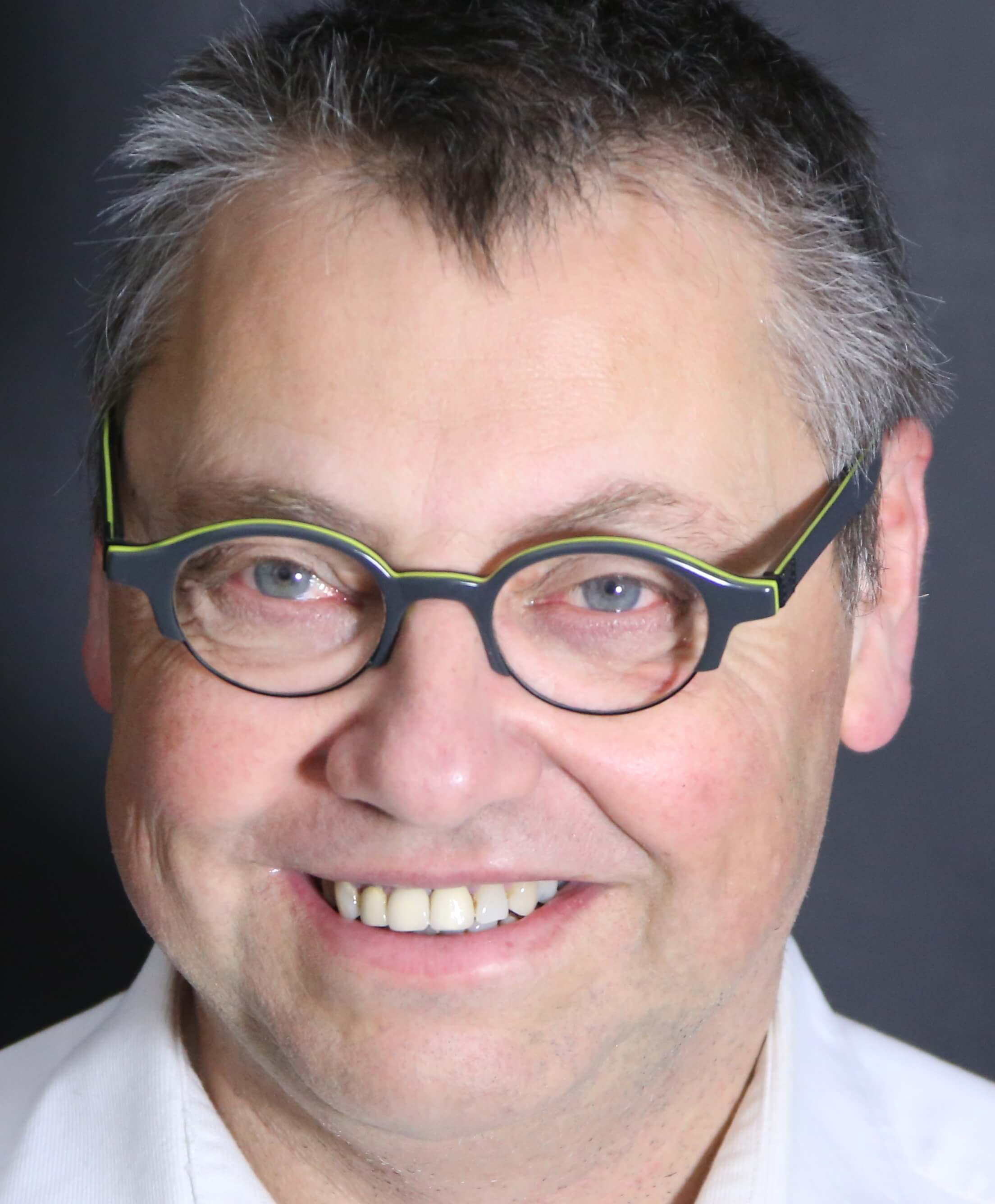
Klaus Deininger
Klaus Deininger is Lead Economist at the Development Research Group pf the World Bank. His areas of research focus is on income and asset inequality and its relationship to poverty reduction and growth. Access to land, land markets and land reform and their impact on household welfare and agricultural productivity play a major role in reducing poverty. Land tenure and its impact on investment, including environmental sustainability in turn are core economic factors for growth but also a better livelihood. In his blog Klaus Deininger says that: "Advances in earth observation, computing power, and connectivity have tremendous potential to help governments, and us at the World Bank, support better land management, and ultimately reduce poverty and promote shared prosperity." In a recent interview with Geospatial Media he further notes that: "...we are increasingly helping countries to develop Open Source solutions to make sure that they can be maintained in the long run." Klaus Deininger is a German national with a Ph.D. in Applied Economics from the University of Minnesota, an MA in Agricultural Economics from the University of Berlin, and an MA in theology from the University of Bonn.
Peter Kusterer
Peter Kusterer is heading Corporate Citizenship & Corporate Affairs in IBM Germany since 2008. Being more than 30 years with IBM he held various executive positions also oversseeing international operations in Europe, Middle East and Africa. He holds a master of business administration (Diplom-Kaufmann) of the University of Cologne (1983).
Besides leading Citizenship for IBM Germany he is member of the steering commitee of a business network of Citzenship managers, member of Bundesnetzwerk bürgerschaftliches Engagement, a cross-sector net work on civic engagement for Germany, and different regional CSR networks. His focus is on Corporate Volunteering/probono as a unique form of civic engagement and foundation of corporate culture. Additional areas of his work are the impact of digital transformation on education systems and civil society organisation. Currently the migration challenge and the contribution of business consume a large part of his activities among which he also engages in his community's refugee initiative.
He is married and has two children.Dirk Frigne
In his professional life, Dirk is founder and CEO of Geosparc. He has extensive software development experience as a developer, architect, project manager and has been involved with the development and implementation of numerous IT infrastructures using a variety of technologies on multiple platforms. In an IT career spanning more than 30 years, Dirk understands that leadership and team building are the keys to successful IT and development projects. His key skills are situated in the valorisation of specialised state of the art technology trough bringing technical experts into contact with the right commercial and marketing teams for a perfect fit. Dirk was project manager for several projects amongst them, the open source project “Generic GIS for e-Government” and the OSGeo project Geomajas. Dirk is is a member of the advisory board of the Industrial Industry Fund (university of Ghent) and part of the "geospatial datainfrastructure" (GDI) advisory board of Flanders. Dirk is an OSGeo member since 2007, became a charter member in 2013 and is since January 2016 vice president of OSGeo.
In 2015 Dirk took the initiative, together with a team of enthusiastic open source adepts to found The Belgium OSGeo local chapter, and is actively involved in the organisation of the Belgian FOSS4G.be event.
Dirk is evangelising the foundation of the European chapter, which is right now under construction, discussing the goals and principles.Thomas Zerweck
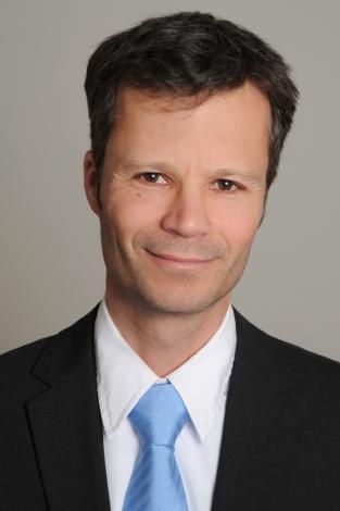
Thomas studied geography in Munich and Bonn and finalized with a grade as M.Sc. in Geography. His thesis dealt with high mountain research and GIS. From 1998 to 2003 he was co-founder and managing director of ZEBRIS, Geoinformation Systems and Consulting, a SME located in Munich. The company provides services and products in GIS, Remote Sensing and Environmental Management. From 2004 to 2014 he was a freelancing GIS Expert for various companies in GIS Development, Business Analysis, GIS Architecture and Project management and also lecturer for Web Cartography at the Department of Geoinformation of the University for applied sciences in Munich.
Since 2014 he is expert for Geospatial Solutions at Munich Re, one of the biggest reinsurance companies in the world. His main responsibilities are building a Geospatial Platform within the company and for Munich Re’s Partners and clients; providing business units with Geospatial consulting; transferring geospatial data, services, solutions and know-how to the business; integrating GIS and Remote sensing information from satellites and drones into Risk and Claims management.Ton Zijlstra
Ton Zijlstra (1970) is an independent change management consultant, with a preference for complex change issues provoked by new technology. He has a background in technology and philosophy. With 15+ years experience in how digitisation changes the ways we work, learn, connect, live, and how it shapes the networked society, he has a thorough understanding of the social impact of digital technology. Working from his hometown in the Netherlands across Europe and beyond, he is a key connector and enabler for open data.
Since 2008 he has been active in open (government) data which he sees as a next wave of digital disruption creating new opportunities and challenges for public sector bodies, citizens and corporations alike. He worked and works for various local, national and international government bodies to help 'do' open data on both the strategic and operational level. He did the first exploration of open data for the Dutch government, and in 2010 created the plans for the Dutch national data portal. A 2 year stint as project lead of the ePSIplatform.eu for the European Commission, further strengthened his connections to most open data initiatives in the EU. Since 2011 he has worked with the World Bank, most recently as senior expert on open data in Kazachstan, Kyrgyzstan, Malaysia and Serbia. In 2011, together with three colleagues he founded the open data consultancy company The Green Land, http://thegreenland.eu, working with government bodies across Europe..
In his spare time Ton works on another digital disruption wave: digital manufacturing and FabLabs. He was the chairman of the FabLab Foundation in the Netherlands, Belgium and Luxembourg, a network of 25 FabLabs, and still advises FabLabs on a regular basis. He was 2010-2015 also a voluntary board member of the 10.000+ Dutch community "Civil Servant 2.0" which focusses on the changing work routines of the public sector under influence of social media, co-creation and open data.
He is a regular speaker and guest lecturer across Europe on diverse aspects of the impact of digitisation: networked learning, complexity management, social media, open data, and digital manufacturing. Every few years he organizes a conference in his home on these topics, for clients, friends, family and peers as a birthday party. Anton has been blogging at http://zylstra.org/blog about his professional interests since 2002.Blog: http://zylstra.org/blogLinkedin: https://linkedin.com/in/tonzijlstraTwitter: https://twitter.com/ton_zylstraCompany: http://thegreenland.eu/ -
Topic Talks
“An overview of the best Free and Open Source Software for Geospatial“
Angelos Tzotsos
This session provides an overview of the breadth of quality geospatial open source applications, which are available for the full range of geospatial use cases, including storage, publishing, viewing, analysis and manipulation of data.
This session includes an introduction to the OSGeo-Live project, a short description of the included software, short presentations from contributors and linked projects, an in-depth technical discussion of the build process and a discussion of the future roadmap.
The introductory presentation is based upon documentation from OSGeo-Live, which is a Lubuntu-based geospatial GNU/Linux distribution delivered as a self-contained DVD, USB thumb drive and Virtual Machine. It includes over 50 of the best geospatial, open source applications, pre-configured with data, project overviews and quick-starts, translated into multiple languages. It is an excellent tool for demonstrating GeoSpatial Open Source, using in tutorials and workshops, or providing to potential new users. This presentation is very useful for anyone wishing to gain a high level understanding of the breadth of geospatial open source available.
“become INSPIRE'd by OSGeo“
Dirk Frigne, Robin Smith
Raise interest in the new opportunities INSPIRE will introduce for FOSS
INSPIRE is an important EU directive which matters to OSGeo members. Many of us are already part of it... and this is only the beginning. The INSPIRE's technical framework will evolve and there is an immense opportunity for open source communities to help and benefit. Examples and idea's will be presented and the way forward for OSGeo will be discussed.
For the business people amongst us, there will be business opportunities to help implement INSPIRE or build applications on top of it.
for the academic, there will be research opportunities, to make use of the data coming from the infrastructure, making it easy to analyse official data.
and for the people working for government it is a great opportunity to get into contact with a great eco-system of people connected into great FOSS projects.
The results and conclusions of the workshop at GWF in Rotterdam from May 2016 will also be presented.
A not-to-miss event for everybody seriously involved in FOSSGIS!
“Disaster Mapping: Challenges and opportunities in improving crisis response and peacebuilding through Collaborative Mapping, Open Source Geospatial Technologies and Open Data"
Lars Wirkus, Fabian Selg
Organizers:
International Working Group on Satellite Based Emergency Mapping (IWG-SEM)/ UN-SPIDER, Bonn International Center for Conversion (BICC)Description:
In satellite-based and participatory crisis mapping, collaborative sharing and editing of (geo-) information is crucial to a successful response. Free and Open Source tools and technologies represent a cornerstone in many collaborative mapping approaches. We invite software developers, data producers and end-users of information to participate in the exchange of best practices, open issues and experiences, particularly within the collaborative mapping workflows of information sharing, real time editing and evaluation. Besides practical aspects also ethical challenges in collecting, providing, sharing and visualizing data in an open and secure manner during emerging crises as well as the responses thereof will be addressed.Tags:
Earth Observation, Open source Geospatial Technologies, Satellite Images, Remote Sensing, Open Data, Collaboration, Humanitarian, Disaster, Emergency Response“Open Data with Open Software - the Copernicus Programm“
Christian Strobl, Markus Neteler
The Copernicus programme of the European Union provides Terabytes of remote sensing data every day. The continuing processing of this huge amount of data with open source software is a chance and a challenge for many organisations. In this topic talk we discuss real world applications and show also technical solutions for processing chains based on Sentinel data.
“From big to small, and keeping track of it all - what is LocationTech working on?“
Andrea Ross, Rob Emanuele, Joe Allnutt
LocationTech is a geospatial working group hosted by the Eclipse Foundation, a not-for-profit hosting open source projects. The group has just turned 3 years old, and continues to grow. This topic talk presents a series of talks on what LocationTech has been working on.Processing Geospatial at Scale
LocationTech is home to set of 4 open source projects dealing with large geospatial datasets: GeoTrellis, GeoWave, GeoMesa, and GeoJinni (sense a pattern?).These projects were created to solve the type of problems that we are seeing more and more of: how do we ask very large geospatial data questions concerning location? In this talk, Rob will give an introduction to those four projects, and talk about how each project approaches processing geospatial data at scale.
This talk covers the basics, such as:
- what does "processing geospatial data at scale" mean exactly?
- a introduction and history of Hadoop, Spark, and Accumulo
- What are GeoTrellis, GeoMesa, GeoWave, and GeoJinni? How are they different?
If you're new to distributed processing, you should leave this talk with a better sense of the field, and if you're a veteran, you should leave with a better idea which of these project might fit your distributed geospatial processing needs.
GeoGig: A Git-Like Approach To Geospatial
In the talk Joe will: Explain how to get up and running with GeoGig Work through how to manage changing datasets Demonstrate the QGIS GeoGig Plugin Run through using GeoGig to work with example open data Walk through a scenario with multiple distributed contributors Talk through the findings of TechLab's work with GeoGig so far
“How Open Source and Open Standards development profit from each other“
Athina Trakas, Ingo Simonis
This topic talk highlights the close relationship of Open Source software and Open Standards development. The coordination of increasingly faster development of geospatial Open Source software and more longer term oriented standards presents some challenges which have been identified and taken up by key organizations of the domain. Building on the geospatial track of the Apache: Big Data 2016 Conference one aim is to follow up on identified project coordination actions to be undertaken after the Apache Conference.
“Open Source Tools and Governance for Land Management“
Arnulf Christl, John Gitau
Access to land, land ownership and tax on real property are the key assets of any national economy. Good governance in land management is a key factor for social stability, prosperity and economic development. One key component for good land management is location based data and the information that be derived thereof. Many nations still even lack basic maps to help identify issues in land governance. With the growing availability of air borne and satellite acquired geospatial data, Open Data projects like OpenStreetMap are growing and start to play an increasingly important role for land management, especially in the so called developing world. This Topic talk will explore the opportunities Open Source tools provide for processing and analyzing geospatial data for Land Management. The associated open governance models are key to the success of implementing sustainable solutions on nationwide distributed systems based on the mantra of thinking globally and acting locally.
-
Scientific Track
As in previous FOSS4G conferences the FOSS4G 2016 Scientific Track provides a strong basis for building bridges for intensified collaboration among researchers, developers, users, and practitioners carrying out research and development in the geospatial field using open source geospatial software, standards.
We feature academic papers describing:
- the use of open source geospatial software, standards, and data, in and for scientific research, as well as
- academic endeavours to conceptualize, create, assess, and teach open source geospatial software and data.
In May the chosen papers will be announced
Themes
We will feature contributions from the following themes:
- Architectures and frameworks for open source software and data
- Business Models for Open Source / Open Data
- Data Quality, Software Quality and Service Quality
- Community Building
- Doing more for less: Assessment of costs and benefits of open source applications and open source business models
- Use of Open Data in public administration and services
- FOSS and FOSS4G: Is spatial special?
- Approaches to combine open and closed software
- Teaching Geospatial Sciences with open source solutions
- History of Geospatial Open Standards
- Open Database Protection
- Open Data Resources, Linked Open Data, Open Data Commons, Open Data Best Practices
- Open Data Technologies and Interoperability
- Cross-border approaches, Political Open Data Support, Licensing Policies
- Open Source GIS application use cases, i.e., in planning, administration, infrastructure, environment and disaster management, and business
- Implementation and benefits of open standards, needs for further developments in standardization
- Location Based Services
- Indoor and Outdoor Location and Mapping
- Unmanned Aerial Systems: Open Hardware and Software
- Urban Science/City Analytics
- Citizen science and user generated content
- Big Geo Data
- Internet of Things and Internet of Places
We invite academics and researchers to submit full papers in English, of maximum 6,000 words, before the deadline. Submissions should follow the templates provided [5].
Important Dates
-
Paper Submission Deadline: March 21th 2016 -
Extended Submisson Deadline: March 28th 2016 -
Decision Announcement: May 15th 2016 -
Revisions Due: July 5th 2016 (planned)
-
FOSS4G Conference: August 24h-16th 2016
-
Final submission for the journal: September 2016
Review process
We expect to select 20-25 papers for presentation and publication. Your contributions will be reviewed (double-blind) by geospatial experts, who will assess the papers on originality and academic rigour, as well as interest for the worldwide FOSS4G and Open Data community.
Based on your presentation in Bonn, as well as discussion with the editors, a final selection will be made, and a final round of editing will be undertaken. In this way we hope to encourage and help especially early-stage researchers (PhD students, post-doc scientists) to strive for high-quality papers.
8-10 papers will be published in a special issue of the renowned international online journal Transactions in GIS [1] and/or the International Journal of Cartography which was recently launched [2]. The remaining papers will be published in the online OSGeo Journal [3].
Contact:
If you have any questions, please contact the chairs of the academic committee:
-
Dr. Franz-Josef Behr, Professor of Spatial Information Processing, Hochschule für Technik Stuttgart, franz-josef.behr@hft-stuttgart.de
-
Dr. A.P. Pradeepkumar, Professor of Geology, Dept of Geology, University of Kerala, Trivandrum, geo.pradeep@keralauniversity.ac.in
[1] Transactions in GIS. Published by Wiley; impact factor 1.398; SI Journal Citation Reports © Ranking: 2014: 26/76 (Geography), edited by: John P. Wilson, Qiming Zhou and Alex Singleton. Online ISSN: 1467-9671. http://onlinelibrary.wiley.com/journal/10.1111/%28ISSN%291467-9671
[2] International Journal of Cartography. edited by: William Cartwright and Anne Ruas, ISSN 2372-9333 (print), 2372-9341 (online). http://www.tandfonline.com/action/journalInformation?show=editorialBoard&journalCode=tica20
[3] OSGeo Journal, the official Journal of the Open Source Geospatial Foundation; http://journal.osgeo.org/index.php/journal
[4] FOSS4G 2016, Time Schedule: http://2016.foss4g.org/programme.html#overview
[5]Template for submission: http://2016.foss4g.opencts.org/downloads/FOSS4G2016_templates.zip
-
Poster Session
In addition to scientific papers the Scientific Track Committee also reviewed posters for the scientific poster session. Submission is closed now.
GIS.lab: Hydrological modeling on the Web
LandaOSPER — a real-time environmental sensor platform
Kryvych, Fiddes, Calbimonte, Fierz, et al.Development of OGC WPS-based Climate Data Visualization Service Using PyWPS and Matplotlib
LeeClassification of land use/cover change in the Kanto region, Japan using FOSS4G and Open Data
Iwasaki, Sprague, Sprague, Onohara, et al.Shapefile Projectionfinder
EggerGeoTools extension for 3D Geometry
Kim, Kim, Ryoo, Seo, LiDubaisat Vegetation Monitoring Tool for Mobile Devices
CalistoCocobot:An Efficient Road Change Detection System using GPS Trajectory Data Set
Chung, KimHow to cross a square?
MikschModelling concrete and abstract geoprocessing workflows with ILWIS 4
LemmensDevelopment of Environment Spatial Information Service Utilizing Mobile Location-Based Technology
YoonOpen Source Geospatial Applications to support River Basin Management in Kharaa River Basin (KRB), Mongolia
Hofmann, Bremerich, Gröning, Jansen, et al.Modelling Population Interactions: the PySAL and Open Source Way
BarryAn Open Source Solution for Rapid and Automatic UAV Mapping
CheonTurning Copernicus Sentinel-2 data into OGC Web Services
NetelerSpatial Modeling of Field Traffic Intensity using Open Source GIS Applications
K. Augustin, M. Kuhwald and R. DuttmannThe Construction of Open Data Portal using DKAN for Integrate to Multiple Japanese Local Government Open Data
Toshikazu Seto, Yoshihide SekimotoWeb Platform for Data Visualization and Sharing
Siwoon JungImportant Dates
Poster Submission Deadline:May 26th 2016Decision Announcement: June 15th 2016- FOSS4G Conference: August 24h-26th 2016
Review process
16 posters were selected for presentation at the conference. The contributions were reviewed (double-blind) by geospatial experts, who assessed the posters on originality and academic rigour, as well as interest for the worldwide FOSS4G and Open Data community.
Contact:
If you have any questions, please contact the chairs of the academic committee:
- Dr. Franz-Josef Behr, Professor of Spatial Information Processing, Hochschule für Technik Stuttgart, franz-josef.behr@hft-stuttgart.de
- Dr. A.P. Pradeepkumar, Professor of Geology, Dept of Geology, University of Kerala, Trivandrum, geo.pradeep@keralauniversity.ac.in
-
Map Gallery
We have 5 digital maps to show:
-
Workshops
22th - 23th August
Taking part in a workshop is your opportunity to learn how to apply or develop OSGeo software and other open source geospatial tools directly from the people who are the core developers of this software.
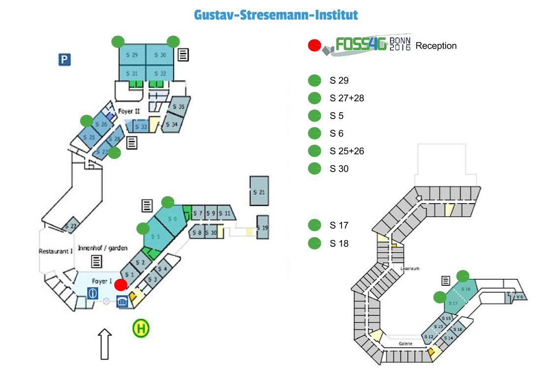
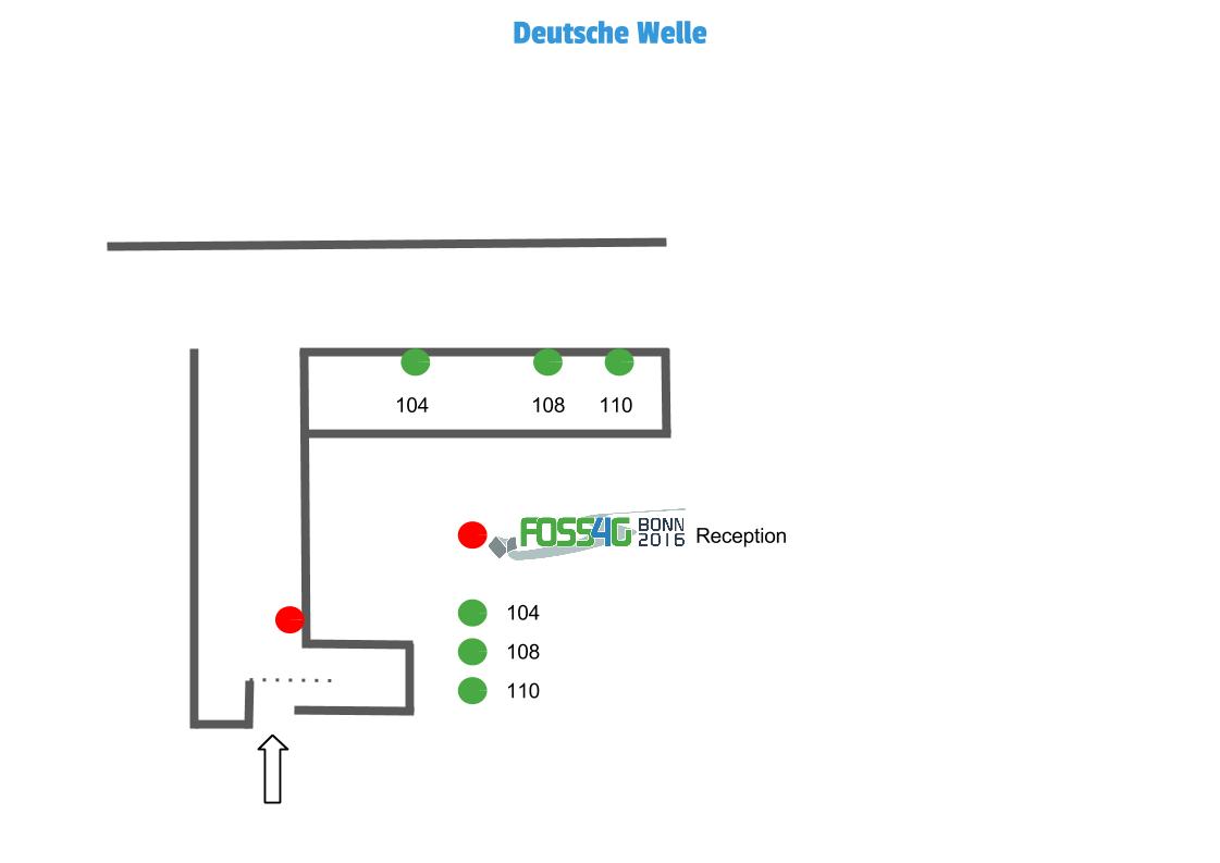
Workshops are a valuable component of every FOSS4G conference. They are 4 hours instructional sessions in a computer lab setting. Workshop instructors provide software, data and materials to instruct 20 to 30 people. We have 10 rooms in parallel equipped with computers for the participants (one computer for two participants) which are set up with the most recent OSGeo Live Environment. There are two more workshops whithout computers.
If you booked a workshop at FOSS4G 2016 in Bonn, here are some information for you:Please find out the location of your workshop in the schedule below. It is either Gustav-Stresemann Institut (where most workshops are) or Deutsche Welle. Find out how to get there here. We open the registration at each location at 8 o'clock for the morning workshops and at 13 o'clock for the afternoon workshops. Please consider waiting times to plan your arrival for the workshops to start on time.
You don't need to bring anything except your workshop description says so or your workshop leader informed you otherwise. During the workshop you will share a laptop with another participant.
If you booked a morning and afternoon workshop on the same day, you will get lunch.
Schedule
Monday - 22nd
location: Gustav-Stresemann-Institut e.V
Session
CodeMorning 9-13 Room lunch
13‑14Session
CodeNoon 14-18 Room WS01 ZOO-Project Introduction Workshop S 17 WS12 PyWPS Workshop S 17 WS02 gvSIG Desktop developer workshop: how to create plug ins using Java
S 18
WS13 Running INSPIRE Download Services on Docker with deegree and PostgreSQL S 18 WS03 Introduction to GeoTools S 5 WS14 GeoTools DataStore Workshop S 29 WS04 Hands-on mapping with Mapillary S 29 WS15 Creating Leaflet plugins S 27+28 WS05 Mapbender3 - get to know the powerful Geoportal Framework S 27+28 WS16 Introduction to OpenLayers S 5 WS06 Web mapping with OGC services and GeoServer: an introduction S 6 WS17 Beyond GeoServer Basics S 6 WS07 QGIS from vector to raster and back again S 25+26 WS18 Advanced spatial analysis with the QGIS Processing framework S 25+26 WS08 Workshop: Building Dynamic Maps with CartoDB S 30 WS19 Publish your geodata in online/offline mobile apps S 30 location: Deutsche Welle
Session
CodeMorning 9-13 Room lunch
13‑14Session
CodeNoon 14-18 Room WS09 Massage your Point Cloud data 108 WS20 Geopaparazzi and gvSIG: never out of data in the field 108 WS10 Managing Versioned Data with QGIS using GeoGig 110 WS21 Which city is the cultural capital of Europe? An intro to Apache PySpark for Big Data GeoAnalysis 110 WS11 Introduction to Open Source Geospatial 104 WS22 I have data with TIME, ELEVATION and other dimensions: what can GeoServer do for me? 104 Tuesday - 23rd
location: Gustav-Stresemann-Institut e.V
location: Deutsche Welle
Session
CodeMorning 9-13 Room lunch
13‑14Session
CodeNoon 14-18 Room WS30 Creating WebGIS Applications with GeoExt 3 104 WS42 FOSS4G routing with pgRouting 104 WS31 Managing CityGML-based 3D city models in PostGIS
and Cesium using the 3DCityDB Stack110 WS41 Serve your GIS 3D data to the Web 110 Roomplans
Important Dates
Call for Workshops starts 21st JanuaryCall for Workshops closes 21st MarchWorkshop Selection Results will be announced on 8th AprilDetailed Workshop Program will be announced on 15th AprilWorkshop leader/s have to register until July, 10th- Workshop will be on 22th and 23rd August
If you have any questions please contact workshops@foss4g2016.org
-
B2B Meeting
23rd August
FOSS4G is a platform for business and networking. Companies, contractors, and freelance developers do business with and around geospatial Open Source software. Without this commercial backing the community would not have been able to experience the growth it has in the past years.
Networking and collaboration is an especially strong asset when it comes to make business in the Open Source realm. Customers heavily rely on networking between businesses, often without even knowing. At the same time Open Source is heavily competitive and both know-how and experience are scarce to find. Therefore it is crucial to grow and sustain partnerships and rely on networking.
FOSS4G offers a unique opportunity for businesses large and small to meet once a year and exchange ideas, get updated and talk business. The premier event to get started is the Business to Business conference on Tuesday, August 23rd, just a day before the main conference starts. The format we've chosen for this B2B is called "Pecha Kucha" (http://www.pechakucha.org/). Every participant gets a chance to present their business – in exactly 5 minutes (not six!), with exactly 20 slides which are on screen for 15 seconds each. This format keeps presentations concise and fast-paced and will liven up our "Pecha Kucha Night". The order of the talks will be drawn live, so that you never know, when your time comes.
At the end we will vote and determine the best presentation and ask the presenter to give another 5 minute talk - based on our slides ;-). Besides the Pecha Kucha talks there will be plenty of space, coffee and time to get into direct contact with all other participants.
All this happens right before the main conference starts, so that you have lots more opportunities to build your network!
Attending the B2B conference is free for all sponsors. We are happy to invite everybody else but have to ask you to buy a ticket for 35,- €. The B2B event will take place on August, 23rd in IHK Bonn from 11:30 to 17:30. After the event we will start our first pub night in Bonn to continue networking.
If you have any questions please contact info@foss4g2016.org
Preliminary Schedule
Address of IHK Bonn:
Bonner Talweg 17
53113 Bonn
Germany
11:30 Start/KickOff 11:45-12:30 1st block of presentations 12:30-13:00 Break 13:00 Keynote Andrea Ross 13:45-14:30 2nd block of presentations 14:30-15:00 Break 15:00-15:45 3rd block of presentations 15:45-16:15 Break 16:15-17:00 4th block of presentations 17:00-17:15 Final: Vote for winner 17:20-17:30 Winners talk 17:30 Official end 18:30 Walk to the Official Reception of the City of Bonn Keynote:
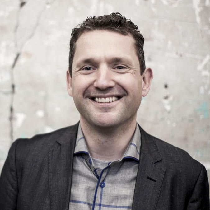
Andrea Ross, Location Tech, Eclipse Foundation
Busting Myths part 2: Is Open Source anti-business?
This talk by Andrea Ross explores various facets of how Open Source and business relate. Is Open Source hostile to business? Can businesses make money with Open Source? What is the history here? How have things changed over time? What are some of the best practices that people can learn from? This talk aims to provide a primer on this interesting topic.
Moderator:

Isabell Chumi
Isabell Chumi, 26, is a pharmaceutical Account Manager at the full Service agency Publicis Pixelpark (Cologne, Germany). She holds a Bachelor's degree in "European Public Health" and "International Health" from Maastricht University, Netherlands. Additionally she holds a Master's degree in "Health Economics" from UDE, Germany. Before joining Publicis Pixelpark, she worked at the Federal Ministry of Health Education in Germany. Football, sports and interacting with other people are her great passions.
-
Code Sprints
Part I: 21st - 23rd August
Part II: 27th - 28th August
location: BaseCamp Bonn
This year, once again, we are following the old tradition of hosting a codesprint on the FOSS4G. More precisely, we offer a setting so that individual projects can meet for their codesprint. Since projects benefit from each other as well, the codesprint will naturally be held conjointly at one place.
Unfortunately, circumstances have forced us to divide the codesprint timetable-wise.The first part is scheduled to take place directly before the conference, the second immediately after. The first two and a half days start on Sunday, August 21, 2016 at around noon and are scheduled to end on Tuesday, August 23, 2016 (open end). The 2nd part starts in the morning of Saturday, August 27, 2016 and ends on Sunday at 12 pm.
We are happy to have found a really awesome location for you. Codesprint and accommodations are combined in one hall. Check out http://www.basecamp-bonn.com for details about the venue.
Working zones will be created for you in the breakfast area and hallways. There’s the option of finding relatively inexpensive sleeping accommodations in train sleeping cars, camping buses, classic cars and more. Additionally, an outdoor area is available for you to enjoy Bonn’s summer weather in August, while working. Healthy and not-so-healthy catering of drinks and snacks will be provided by us. Participation in codesprint is free of charge. However, overnight stays will have to be reserved and paid for by you.Another hint: the BaseCamp is within walking distance from the conference venue (WCCB) and has good access to public transportation – the Icebreaker takes place here, too.
You see, it’s worthwhile booking here!As the accommodations are available to all FOSS4G participants, we will make an effort to make advance booking possible for you a few days ahead, to ensure you have the opportunity to sleep on-site and wrap up the evenings jointly. For that, it’s necessary for you to sign up (https://wiki.osgeo.org/wiki/FOSS4G_2016_Code_Sprint) and leave your email address so that we can contact you immediately when accomodation booking is available. In case BaseCamp is booked out, the hotel Bonnox) is nearby. We need your sign-up for the planning of snacks and drinks, too!
This is open to all who wish to participate in one or more projects. There’s always plenty to do – it’s not all about programming. Translation, documentation, feedback, discussions, testing – all this is also important for project so everyone is cordially invited to attend the codesprints! Registration with the conference is not a prerequisite for participation in codesprint.
One thing we’d like to ask you: with an approx. 120 participants anticipated, the WLAN capacity will naturally be exhausted at some point. Please be sure to avoid huge on-site downloads of data, as this could impact the work of others. Thank you!
The Codesprint Organizing Team is looking forward to welcome you!
If you have any questions please contact codesprint@foss4g2016.org
-
Student's Presentations
On our student session we will have 4 talks. The students session will start Friday 14:30 in the Rhinelobby.
Programme
Jakob Miksch Routing through Open Spaces Stefan Schreinemacher Applying smartphone sensors for evaluating sidewalk quality Javier Muro LST time series analysis to uncover trends in Wetlands Fabián Santos Genetic algorithm approach to calibrate a processing chain for a Landsat-based